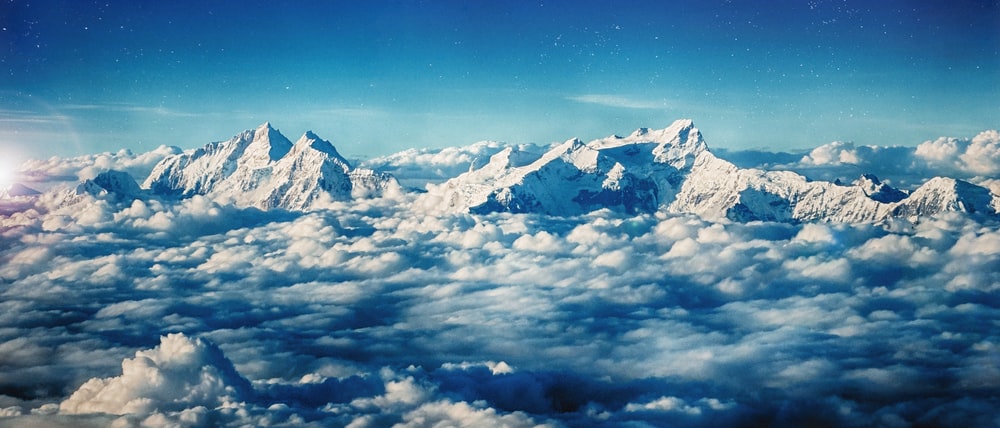
The Himalayas, great mountain range of Asia forming a barrier between the Tibetan plateau to the north and the alluvial plains of the Indian sub-continent to the south. In Hindu Religion, the Himalayas are known as the GIRI-RAJ which means the (king of the mountains). The Hindu people considered the Himalayas as the most chaste (pure) and saint place and believe it to be the willing place of gods. It has got mentioned in the epic Ramayana, Mahabharata, Rig-Veda and many other Puranas. Many saints regard the Himalayas as the land of holy practice and best place to worship for god.
The name derives from the Sanskrit word Himalaya (Him+alaya), where hima means ‘snow’ and alay stands for ‘house’. By integrating the two, it becomes ‘abode of snow’. These mountains are known as Himalaya in Nepali and Hindi language (where both written as हिमालय), The ‘Land of Snow’ in Tibetan language and ‘Ximalaya Mountain Range’ in Chinese language.
These Himalayas are geologically young and structurally fold mountain ranges which lies in South Asia separating the plains of the Indian sub-continent from the Tibetan plateau. These Himalayan Mountain ranges begins in a west direction from the Indus and ends in a east direction to Brahmaputra. The Himalayas Mountain represent the loftiest and one of most uneven or jagged mountain surface in the world. These Himalayas Mountain form an arc, which covers a distance of about 2400 km. Their width varies from 400 km in Kashmir to 150 km in Arunachal Pradesh in the east.
From contemporary times, Himalayas have offered the greatest attraction and greatest challenges to the mountaineers throughout the world. That’s might be one of the most popular reason that every year there is increase in the climbing Himalayan mountains expedition. Climbers from different country came and put their heart and soul to scale Himalayan mountains. The Himalayas Consists of some of the highest mountains in the world with more than 110+ peaks rising to the elevations of 23000 feet (7000 meter) or above the sea level. The 15 highest mountains in the world are in the Himalayas. Some of the highest mountains are Mt. Everest, Annapurna, K2 (Godwin Austin), Nanga Parwat, Kanchanjunga, Nanda devi, Makalu, Lhotse, etc. Mt. Everest is the highest mountain on Earth (8848 mts). Of the 15 highest mountain peaks in the world, Nine highest mountain peaks are present in the Nepali Himalayas.
The Himalayas are so high that they kept the Indian and Chinese people separate from each other. Actually it acts as the natural barrier to safeguard their frontiers. North of Himalayas is the Tibet Plateau and is called the ‘roof of the world’. However, Tibet Plateau is very much dry because the plateau and the mountains act as gigantic rain shadow. South of the Himalayas is the Indian Peninsula and it is often called as Indian Subcontinent and it is because it is larger and more isolated than any other peninsulas in that region. Indian Subcontinent climate is greatly influenced by Himalayas. It is because not only it acts as the natural blockage for extremely cold winter winds that blows from central Asia. It also forces the Bay of Bengal Monsoon to shed its moisture in Northern Indian States, Bhutan, Nepal and Bangladesh.
-: The Formation Of Himalayas :-

Himalayas were formed due to the collision of southern peninsula which is the Indo-Australian plate which was part of Gondwana land plate it collided with the Eurasian plate which was the part of laurasian plate or Angaraland plate. And both Laurasian plate and Angaraland plate together form the super continent of Pangaea. So, if there was a collision of these two plates then we must understand the process of the collision. The collision process must be like either both the plates comes to each other or the other may be one of the plates may be static and the other may gets attracted.
Basically, the Eurasian plate was static and Indian peninsula plate approached to Eurasian plate to collide with it. So, its means that before collision they are far from each other. Before 225 million years ago, all the continents are the part of super continent and are attached to each other and the name of the super continent was Pangaea.

As time flies the disintegration process starts roughly around 150 million years ago when all the continents slowly started detached from each other. And roughly around 70 million years ago, the Indian peninsula started moving towards Eurasian plates. And Indian peninsula plate is also known as Indo-Australian plate because India and Australia detached altogether and after detachment Indian peninsula or Indian plate they moved towards Eurasian plate and Australia detached and forms a separate continent. The Northern part of Pangaea was Eurasia and North America and both of them were the part of Laurasia or Angaraland. And the Southern portion like South America, Africa, India, Australia, Antartica are together known as Gondwana Land.
As slowly slowly Angaraland and Gondwana Land gets detached then there was a Sea which forms between the two continents and the name given to that sea was Tethys sea( It was a long narrow and shallow sea and there were a lots of sediments present in the sea and these sediments are brought by rivers flowing from these continents into the sea and these sediments slowly becomes metamorphic and sedimentary rock and they eventually form the Himalaya when Indian Australian and Eurasian Plate bump against each other.


All these started roughly around 71 million years ago, When the Indian Peninsula of Indian Australian Plate started moving towards the Eurasian Plate so its direction like something as same as in the above mentioned picture. Roughly around 50 million years ago, the Indian-Australian plate collided with the Eurasian plate. Indian peninsula reached its actual location roughly around 10-15 million years ago but the subduction that happened means the collision of plates started 50 million years ago.
Indian-Australian plate was made of denser material and due to being dense it gets subducted under the Eurasian plate. When two plates collide and converge than due to this folding happens and due to folding sediments gets collected and eventually the Himalayas were formed.
-: Ranges Of Himalayas :-
When we move from North to South the ranges are Trans Himalayas or Himadri, Greater Himalayas or Himanchals and Lesser Himalayas or Shivaliks.
Trans Himalayas or Tibetan Himalayas :-
Trans Himalayas are also called Tibetan Himalayas because most of the Himalayan mountain in this region found in Tibet. The main ranges of Trans Himalayas are karakoram range, Zaskar range Kailas range and the ladakh range.
It is divided into four ranges :-
The first range is the Karakoram range then the south of karakoram lies the ladakh range and below Ladakh range is Zaskar range. These ranges are made up of ocean sediments which were consumed during the collision of Indian and Eurasian plate boundaries.
(1) KARAKORAM RANGE :
Karakoram range has a permanent snow line due to its very high altitude. As far as the location is concerned it begans with the wakhan corridor in the afghanistan in the west and in-compasses the majority of gilgit baltistan (which lies in Pakistan) and ends into the Ladakh of india. Some of the parts are also extends to the disputed region of Akshai chin. Mt.K2 the second largest peak in the world also lies in this region.
(2) LADAKH RANGE :
The ladakh range to the north east to the karakoram range and falls in the Indian state of jammu and Kashmir with its northern tape extended to Gilgit-Baltistan region in Pakistan. These ranges extends into china where they are known as kailash ranges which includes the very important pilgrimage site mt. Kailash parwat and mansarowar lake as well. These ranges separate the river Indus and shyok into two halves.
(3) ZASKAR RANGE :
It is the mountain range in the Indian state of Jammu and Kashmir and extend into Uttarakhand as well. The Zaskar river flows through this range and cuts the deep and narrow Zaskar George. Lipu lake pass that leads to maansarowar and mt. kailas lies in these Zaskar range. The Nanga Parwat which is of the height of 8126 mts also important range of Zaskar range.
(4) KAILAS RANGE :
It is also called as ‘gangdise’ in Chinese. The highest peak of Kailas range is mt.kailas with an altitude of 6714 meters above the sea level. Indus river originates from Kailas range.
-: Greater Himalayas Or Himadri :-
The greater Himalayas is the highest mountain ranges of the whole Himalayan range. It also extents southwards across the Pakistan then northern india then Nepal before entering across Sikkim. Finally after Bhutan it also extends towards north east and north Arunachal Pradesh.
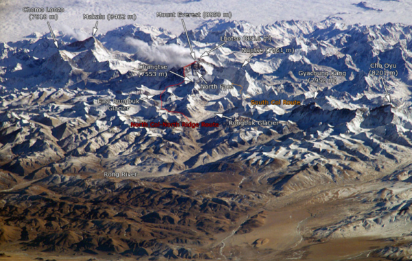
The world’s highest peak Mt. Everest also lies in this Himalayan range. Mt. Everest is called Sagarmatha in Nepal and Chomolugma in China. Its average elevation is 6100m above the sea level and average width is about 25km. They are also known as Inner Himalayas, Central Himalayas or Himadri.
Passes Found In Himadri
| STATE | PASSES FOUND IN HIMADRI/GREATER HIMALAYAS |
| JAMMU AND KASHMIR (J&K) | 1. ZOJI PASS 2. BURZIL PASS |
| UTTRAKHAND | 1. LIPU PASS 2. THANG PASS 3. NITI PASS |
| HIMANCHAL PRADESH (HP) | 1. SHIPKI PASS 2. BARA LACHA PASS |
| SIKKIM | 1. NATHU LA 2. JELEP LA |
These are passes because they are generally higher that 4500 meters above the sea level and they are bounded with snow throughout the year. That is the region they are called pass. (LA stands for pass).
Lesser Himalayas / Middle Himalayas :-
Lesser Himalayas are also called as Lower Himalayas or Himanchal.
Lesser Himalayas are about 2400 km in length and about 60 to 80 km in width.
- Himanchal altitude vary from 3500 to 4500 m above the sea level. The peaks are generally covered with snow throughout the year.
- The lesser Himalayas are more exposed with humans as compared to other ranges.
Important ranges found in Himanchal are:-
| REGION | IMPORTANT RANGES FOUND IN HIMACHAL/ LOWER HIMALAYAS |
| HIMANCHAL PRADESH | THE DHOLA DHAR RANGE |
| JAMMU AND KASHMIR (J&K) | PIR-PANJAL RANGE |
| UTTRAKHAND | NAG TIBA RANGE |
| UTTRAKHAND | MUSSOORIE RANGE |
The middle Himalayas can be divided into two ranges :-
(1) PIRPANJAL RANGE :
It is a group of Himalayas in the inner Himalayan region which is running from east to south east and to west to north west across indian states of himanchal Pradesh and jammu and Pradesh.
(2) DHAULADHAR RANGE :
They are the extension of pir-panjal into the Himanchal Pradesh and partially in uttrakhand.
Upper Himalayas Or Shivaliks :-
The Shivaliks or Upper Himalayas extends from the west of Arunachal Pradesh through Bhutan through West Bengal then Sikkim and further west through Nepal and Uttrakhand and continuing into Himanchal Pradesh and Kashmir.
Shivaliks are the youngest est west mountain chains of the Himalayan region.
- They are also called as outer Himalayas are also known as Jammu hills in Jammu and Kashmir, Dudhwa Range in Uttrakhand, Darjeeling hills in West Bengal and Dafla, Miri, Abor,Mishmi hills in Arunchal Pradesh.
- Tea is a very unique crop which can be grown in Shivaliks.
- The altitude of Shivaliks (upper Himalayas) are about 600 m to 1500 m. upper Himalayas are located between lesser Himalayas and greater plains.
Shivaliks are formed about 2-20 million years ago.
- In different places Shivaliks are called with different names like in Jammu hills it is called as Jammu region, in Uttrakhand it is called as the Dhang range or Dudwa range.
-: Glaciers In Himalayas :-

When talking about glaciers, Himalayan Glaciers are not just frozen layers of snow but these glaciers are the reservoirs of fresh water. These frozen rivers of ice, the glaciers of Himalayas provides water to those in the Indo-Gangetic Plains. Rivers that feed almost half billion of the population in india originates from Himalayan glaciers.
There are about 15 thousand glaciers in Himalayas and the total area of Himalayas are about 5 lakh square km out of which around 33000 sq km of area is covered with snow. And the snow line also varies according to the different parts of Himalayas depending upon multiple factors like latitude, topography, and amount of precipitation.
Some of the glaciers are as follows:-
(1) Karakoram Range Glaciers:-
- In this Karakoram region some of the largest glaciers outside polar and sub-polar regions are found.
- Most of the gingatic glaciers are found in the southern most side.
- The Siachen Glacier is the largest glaciers found in this region and it is around 75 km long and is located in Nubra Valley in Karakoram range.
- Fedchenko Glaciers is the second largest glacier and it is around 74 km long glacier, Hisper Glacier is the third largest and it is around 62 km long and hisper glacier also occupies the tributary of Hunza River.
(2) Pir panjal Range Glaciers:-
- The glaciers of Pir panjal range are generally smaller in size as compared to Karakoram range.
The largest glacier found in Pir-panjal range is Sonapani glacier which is around 15 km long and is located in the Chandra valley of Lahul and Spiti region of Pir-panjal glaciers.
(3) Garhwal Region Glaciers:-
- It is one of the largest around 30 km long glacier which is also the parent source of holy river Ganga.
- Being in Himalaya it is bounded on north by china, on east by Kumaon, south bu up (Uttar Pradesh) and north by Himanchal Pradesh.
(4) Nepal Glaciers:-
Kanchanjunga and Zemu the major glaciers in Nepal glaciers.
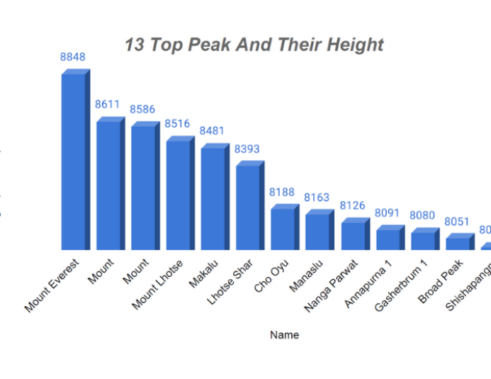
-: 13 Highest Mountain Peaks In Himalaya :-
| S.N | Name | Height ( in meter) |
| 1 | Mount Everest | 8848 |
| 2 | Mount Karakoram | 8611 |
| 3 | Mount Kanchenjunga | 8586 |
| 4 | Mount Lhotse | 8516 |
| 5 | Makalu | 8481 |
| 6 | Lhotse Shar | 8393 |
| 7 | Cho Oyu | 8188 |
| 8 | Manaslu | 8163 |
| 9 | Nanga Parwat | 8126 |
| 10 | Annapurna 1 | 8091 |
| 11 | Gasherbrum 1 | 8080 |
| 12 | Broad Peak | 8051 |
| 13 | Shishapangma | 8013 |
1. Mount Everest :-
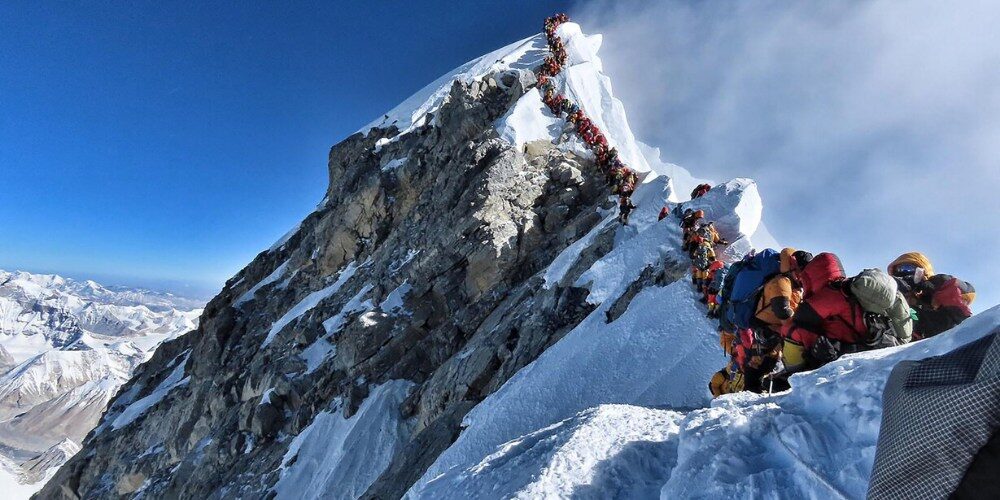
Mount Everest is the tallest mountain peak in the world.
It is situated in Himalayan mountain range near Nepal-Tibetan border. Its also called Sagarmatha in Nepal and Chomolugma in china.
It was formed around 60 million years ago when the super-continent of Laurasia broke up and Indian peninsula plate moved slowly towards north Asia and then bump (crashed) into it. The sea bed between the two plates between the earth crust was crumbled and pushed up to northern rim of India to form the Himalaya and Mt. Everest become the tallest among them.
Mt. Everest is 8848 meter high means 29029 feet high and continuously growing at the rate of 1 to 3 inch every year.
Mt. Everest got its name in the year 1865 after British Government officer (surveyor general Rank officer) Sir George Everest who first located the exact position of the Everest peak in the Himalayan Region.
The Height of Mt. Everest was first published in the year 1856, when it was known as mountain peak xv.
In 1953, the first successful summit of Mt. Everest was done by mountaineer Edmund Hillary from New Zealand and a Nepali Sherpa Tenzing Norgay.
The Average temperature on the top of the peak is below 100 degree below freezing point. And due to this reason still there are a lots of dead bodies still lying on Mt. Everest.
Problems generally faced by mountaineers are very high winds, bad weather, altitude seakness, snow bite.
The death rate in climbing Mt. Everest is very high. As per 2019 report, 300 people lost their life.
Number of Successful Summit (Last 5 years) on Mt. Everest :-
| YEAR | NUMBER OF SUMMITS |
| 2015 | 0 |
| 2016 | 641 |
| 2017 | 648 |
| 2018 | 807 |
| 2019 | 300 |
2. Mount Karakoram :-

Mt. Karakoram is also known as Mt K2. The other name of Mt. K2 is Godwin Austin. Mt.k2 is 8611 meter tall and the second tallest and highest mountain peak in the world.
Mt k2 is located on the Pakistan-China border in Gilgit-Baltistan Region of Northern Pakistan and Xinjiang, China.
Mt K2 is the highest peak on Karakoram range and also the highest peak in both Pakistan-Xinjiang.
Mt. K2 is also known as the savage mountain which means that mountain ‘which tries to kill you’.
Mt. K2 is the deadliest mountain and one of the most toughest mountain to climb.
The death ratio on Mt. K2 is more than the tallest mountain in the world Mt. Everest.
Mt K2 is more dangerous to climb than any other 8000 meter mountain peak.
It is belief that out of every four who tries reach the summit, one person dies and this is the reason which makes this mountain peak “most cruel” among others.
Mount K2 is also known as the ‘Kings of Mountains’ or the ‘Mountains of Mountains’.
It is also known as ‘Chhogori’. Mt. K2 is the only 8000 Meter peak which has never climbed during winter season or from its East side.
3. Mount Kangchenjunga :-

Mount Kangchenjunga is the third tallest and highest mountain peak in the world. It can also be written as Kanchenjunga. Mount Kanchenjunga is 8586 meter tall around 26169 feet. Mt. Kanchenjunga is one of the tallest peak in Himalayas.
Mt. Kanchenjunga lies between Indo-Nepal border. Until 1852, Mt. Kanchenjunga was considered as the tallest Mountain peak in the world but later on different Trigonometrical calculations were made to know which is the Tallest mountain the world and in the year 1856 it was officially announced that Mt. Everest is the tallest in the world and Mt. Kanchenjunga is the third tallest mountain peak in the world.
Mt. Kanchenjunga was first climbed in the year 1955 by Joe Brown and George Band who were the members of British climbing expedition of that time.
When climbers are about to summit they were stopped in between the summit as the promise was given to king of Sikkim that the top of the peak would remain intact. Every Climber till now has to follow this tradition whoever scales Mt. Kanchenjunga.
The death rate in climbing Mt. Kanchenjunga is quite high. Since 1990, more than 20% people lost their lives while climbing the peak.
4. Mount Lhotse :-
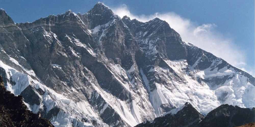
Mt Lhotse is the fourth tallest mountain peak in the world. It is 8516 meter tall about 27940 feet above the sea level.
Mt. Lhotse is the part of Everest chain (massif). Lhotse is located at the South col on the way of Mt. Everest Summit.
The Lhotse summit is on the border between Tibet in China and Khumbu in Nepal region.
In Tibetan Language Lhotse means ‘South peak’.
Mt. Everest is the parent company of Lhotse.
5. Makalu :-
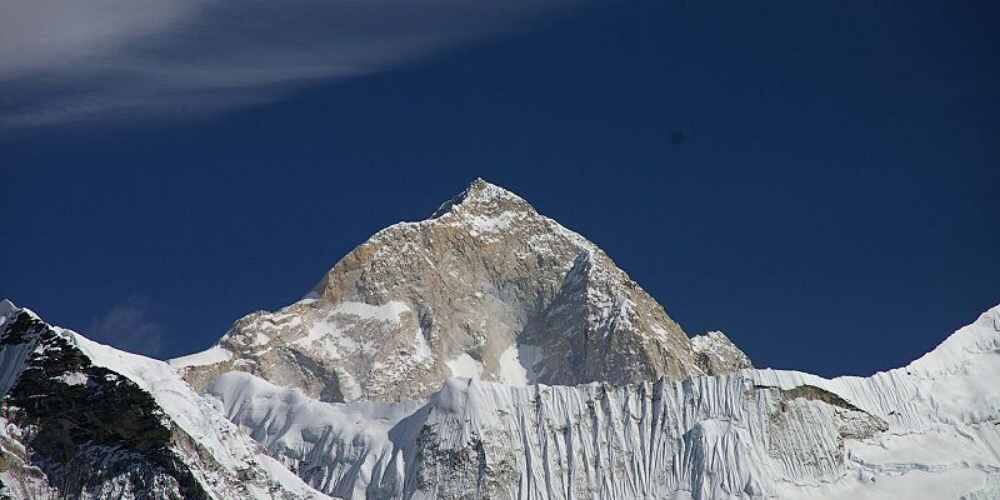
Makalu is the fifth tallest mountain peak in the world.
Makalu is 8485 m tall around 27838 feet above the sea level.
Mahalangur is the Parent Mountain of Makalu.
Makalu is covered with snow throughout the year.
Makalu is located in Mahalangur, Himalayas and about 19 km towards southeast of Mount Everest.
It lies in the border between Nepal-Tibet Region. Makalu is one such isolated peak whose shape is four side Pyramid.
Makalu was first climbed by American team and led by Riley Keegan in the year 1954.
Makalu was first summited in the year 1955 by Lionel Terray and jean couzy of France.
Makalu is the one of the most difficult eight thousanders peak list which is very difficult to climb.
6. Lhotse Shar :-

Lhotse Shar is the sixth tallest mountain peak in the world.
It is 8383 meter tall which is about 27503 feet high above the sea level.
Lhotse was first scaled by Sepp Mayerl and Rolf Walter in the year 1970.
Lhotse Shar is located between the kumbu, Nepal and Tibet, China.
Lhotse is the parent peak of Lhotse shar.
Lhotse shar has the highest death rate of all 8 thousanders mountain peaks which means every 4 people who summit the mountain, two person dies attempting to.
7. Cho Oyu :-

It is 8188 meter high above the sea level.
Cho-Oyu is the sixth highest mountain peak in the world.
Cho-Oyu in Tibet called ‘Turquoise Godess’ in Tibet.
Cho-Oyu is also known as ‘Treking Peak’. And it is the second most climbing peak.
It is located between Nepal china border. It’s first assent happened in the year 1954 by mountaineer Herbert Tichy, Joseph Jochler and Pasang Lama and other members of the team.
And it is also considered as the most trekking peak because the death ration is quite low here.
8. Manaslu :-

Manaslu is the eighth- tallest mountain in the world. Manaslu is 8163 meter high which means around 26781 feet above the sea level.
It is located in the Mansiri Himal, part of Nepalese Himalayas in the western part of Nepal.
Manslu is a word derived from a Sanskrit word which means Soul. Manslu is also known as the ‘Mountain of soul/ spirit’.
Manaslu was first climbed by Japanese in the year 1956. And it is most climbed by Japanese so that’s why its called a Japanese Mountain.
Manslu is the highest peak in the Gorkha region which is east of Annapurna.
Manslu is located in Gorkha, Manang-Gandaki Zone of Nepal.
Mansiri Himal is the parent Mountain of Manaslu. And it is covered with snow almost all throughout the year.
9. Nanga Parbat :-
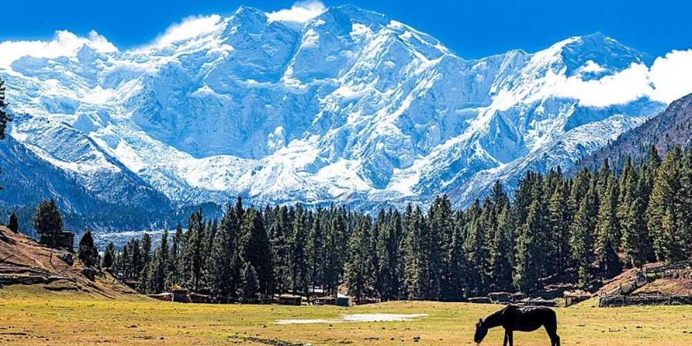
Nanga parbat is also known as Diamer.
It is located in the gilgit baltistan region in Pakistan.
Nanga parbat is the ninth highest mountain peak in the world.
It is 8126 meter tall which means about 26660 feet above the sea level.
Nanga parbat is also considered as the Highest mountain face in the world.
Nanga parbat is also considered as a tough or difficult climbing mountain peak.
Nanga parbat is the word derived from a Sanskrit word (nanag+parbat) means Naked Mountain. In Tibetan it is known as Diamer or Dio Mir which means ‘very huge mountain’.
10. Annapurna 1 :-

Cho –Oyu is the parent mountain of Annapurna1.
Annapauran 1 is located in Gandaki Zone in Nepal.
The Annapurna mountain was named after Hindu goddess of food and nourishment.
Annapurna is the tenth highest peak in the world. It is 8091 meter which is about 26545 feet above the sea level.
Annapurna 1 was the first 8000 m peak to be climbed.
Annapurna 1 has the greatest death rate of all the 14 eight thousanders.
The word Annapurna is derived from a Sanskrit word ‘anna’ means’ food’ and ‘purna’ means ‘filled’. So, by integrating the two (anna+purna)= everlasting food.
11. Gasherbrum 1 :-
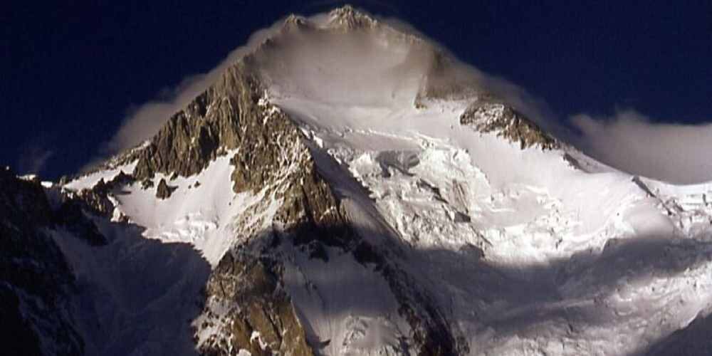
Gasherbrum is the eleventh highest mountain peak in the world.
It is also known as K5 because it is the fifth peak of Karakoram range.
Karakoram range is the parent mountain range for Gasherbrum.
It is also called ‘hidden peak’. It is 8080 meter high about 26510 feet high above the sea level.
It is also known as the ‘shining wall’ because it is very beautiful that is why it is called a shinning wall.
It is located in the Gilgit- Baltistan region of Pakistan. It is a part of Gasherbrum massif and is located in the Karakoram region of the great Himalaya.
12. Broad Peak :-

Broad peak is the twelfth highest mountain peak in the world.
Broad Peak was first ascended in the year of 1957 in June month.
It is located on the border of Pakistan and China. It is 8047 meter high about 26401 feet above the sea level.
Broad Peak is located in Karakoram mountain range and it is at the distance of about 8 km from Mt. K2.
Karakoram mountain range is the parent mountain range of Broad Peak.
13. Shishapangma :-

It is located in South-Central Tibet region of china.
Shishapangma is the fourteenth highest mountain peak in the world.
It is around 8027 meter means around 26,335 feet above the sea level.
It is also known as Gosainthan and is the last peak in the eight thousanders Himalayan mountains list.
It was first ascended in the year 1964 by Chinese Expedition which was led by the leader of the team Xu Jing.
-: 13 Amazing Facts About Himalayas :-
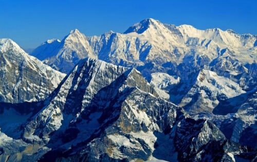
The term Himalaya means ‘abode of snow’. And it is always believed that Himalayan mountain range is the youngest mountain range which lies in five different counties in Asia namely- Pakistan, India, China, Nepal and Bhutan.
In Hindu religion, the Himalayas are known as the GIRI-RAJ which means the god (king of the mountains). The Hindu people considered the Himalayas as the saint place and believe it to be the willing place of gods. It has got mentioned in the epic Ramayana, Mahabharata, Rig-Veda and many other Puranas. Many saints regard the Himalayas as the land of holy practice and best place to worship for god.
One can find various religions and cultures including Hinduism, Islam, Christianity, Buddhism in the Himalayas. The Himalayan people are known to be very friendly and helpful for the tourists visiting the region in every possible manner. There are plenty of beautiful Buddhist Monasteries in the Himalayan region that very attention of the visitors. Tourism has become as increasingly important source of income and the employment imparts in the Himalayas especially in Nepal.
Geologists all over the world are performing different types of tests time to time to prove that the Himalayan Mountains are geologically active and it is also said that it is moving around 20mm every year. And this means that they are getting longer every year.
According to geologists it was stated that around 70 million years ago, there was a very massive collision between Indian plate and Eurasian Plate which results in the formation of the great Himalayas.
Himalayas are 75% situated in Nepal and out of the top fifteen highest mountain peaks in the world nine of them are in Nepal Himalayas.
According to the Hindu Mythology, it is said that lord Shiva used to live in Himalayas.
The Ganges, the Indus, the Brahamputra ( known as Tsangpo in Tibet), the Mekong and many other rivers all originates from the Himalayas means that Himalaya is the source of many rivers( on which good amount of population depends for water). And it is interesting to note that many rivers which originates from Himalayas are actually order than Himalayas.
Himalayas are the home of some of the most rarest species in the animal kingdom. For example. Tibetan Sheep, Snow Leopard, Musk Deer, Mountain Goats, Mountain Buffaloes. Yak is considered as the most common mode of transportation in Himalayan Region.
The Himalayas have the third largest deposition of snow layer in the world. And it is the most attracted mountaineering destination for mountaineers.
The Himalayas covers around 0.4% of the total earth’s area.
A lots of different types of medicinal herbs are found in the Himalayas and are considered to be the most pure medicines in the world with zero side effects. Even one of the Himalayan Fungus is used as medicine to cure impotence.
The Everest was named after survey general of India then Sir George Everest but the reality was that he never saw the mountain. For his splendid service he was remunerated and awarded and the name of the Everest was put after him.
-: 13 Movies Based On Himalayas :-
Whenever we see the images of Himalayas we certainly get goose-bumps by looking at its height, beauty, and the aura it contains. Just think about those who dare to scale such big heights which are very dangerous in reality how it feels to them. By seeing the images only we get excited but think about the situations of those who made it to the summit. As we know everyone can’t go and scale Himalayan Mountains due to several reasons some are quite busy in their day to day activities or those who have time lack funds or due to some other reasons involved.
These Himalayan Mountains are so beautiful that their beauty can’t be described in proper words they can be felt only. So, here I brought some of the movies, documentaries, or television series exclusively based on the Himalayas. And some of the best 13 shows are as follows:-
-: Conclusion :-
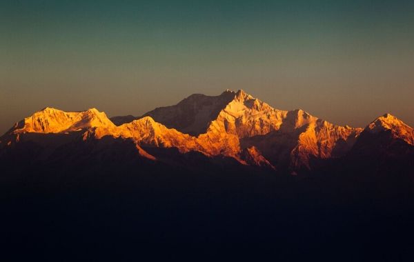
Whenever we hear the name Himalaya, We get excited. Well, why not after all they are the most beautiful and tallest mountains in the world and very dangerous also. All the beauties that the Himalayas carries are just upper looks. They look very beautiful from a distance but in reality, they are very tough, proud and mercy less. Every mistake gets punishment here. Neither they forgive anyone nor do they love. Every year mountaineers from all over the world come for mountaineering in the Himalayas. Besides beauty Himalayas are the homes of many such animals which are very rare. In Hindu Mythology, Himalayas have very great significance and it is considered as the purest place as it is believed that Lord Shiva used to reside in the Himalayas.
[expander_maker id=”1″ more=”Read more” less=”Read less”]
The Himalayas are the center of attraction all over the world. People from all over the world come to see Himalayan Mountains and when they go then they realize certain beautiful changes in their life which changes their vision towards life.
The Himalayas are one of the finest teachers in the world as they taught everyone that if they want to achieve success, want to go high then they must learn teamwork with cooperation (As always said that if one wants to go far they go alone and if one wants to go very far they go in a team) so cooperation is very important in life. As we know, whenever any expedition is launch then many people go together with complete cooperation with each other to attain the ultimate objective that is the final point of the peak means summit of the peak.
Another important thing that we learn from Himalaya is Patience. Whenever mountaineers are in the middle of summit and winds is blowing too fast and even weather conditions are not good and lots of death from the team happened or any Avalanche hits badly then the mountaineers waits for the right time with outmost patience even though is they are just 100 meters away from the summit and once they find that they can step ahead then they go and find their objective. Just like that same applies in our life also when we are facing the worst time of our life instead of panic we should learn to stay calm and patience and keep Hardworking towards our goal.
The Himalayas also taught us about being the determined focus and dedication towards our goal in life. When mountaineers scale the mountains they face many difficulties in between. Sometimes difficulties are so worst that their lives are at stake. But with their firm determination, they overcome the greatest hurdles and attain their objective. For example when ‘Arunima Sinha’ Madam scaled Mt. Everest then she faces a lot of difficulties as we know her legs are not real and she ventured to scale Everest with iron rod legs. And during practice, she faces unbearable pain and continuous de-motivation that arose due to excess pain but as she was a very determined, dedicated women with one focus in life at that point of time that she has to climb anyhow and with her out most extraordinary effort, determination and dedication she scaled Everest.
[/expander_maker]


