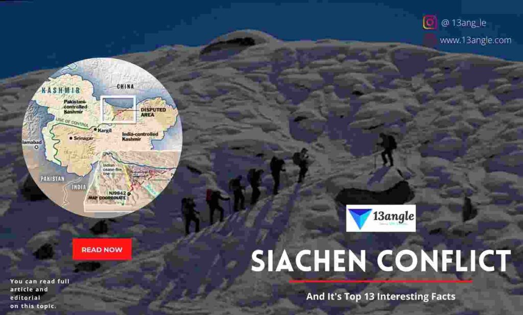
The eastern Karakoram Range of the Himalayas is home to the 75-kilometer-long Siachen Glacier. In the vicinity of Point NJ 9842, the boundary between India and Pakistan is known as the Line of Control. Since 1984, when the Indian Army seized control of the Siachen glacier, a week ahead of Pakistan, the glacier has been a point of contention between the two countries.
After the 1947-48 Indian-Pakistan war, the Karachi Agreement, which ended the conflict, contained ambiguous terms which sparked the unwanted conflict over the Siachen glacier. Kashmir’s Ceasefire Line ran up to map coordinate NJ 9842 and then to the north of the glacier, according to the agreement. The Ceasefire Line was turned into the Line of Control (LoC) as part of the 1972 Simla Agreement, but the ambiguity of the border beyond NJ 9842 was not addressed.
- Advertisement -
After a few years, however, public opinion began to shift. As a result of international publications, including U.S. government documents showing the LoC stretching northeast from NJ 9842 to Karakoram Pass, India became aware of this fact in the late 1970s. In other words, Pakistan was listed as the owner of the Siachen Glacier on maps. Moreover, it learned that Pakistan was quietly establishing its claim over the area by allowing Western mountaineers access to the Siachen and the ridges flanking it. To support its claims to the Siachen, Pakistan resorted to tactics such as cartographic invasion and or politics, according to India. Pakistan had bought the high-altitude fighting gear, and India found out about it in the early 1980s. In April 1984, India sent two platoons of soldiers to the Saltoro Ridge’s Bilafond La and Sia La passes in anticipation of a Pakistani invasion of the Siachen. All tributary glaciers, key passes, and the Soltoro Ridge, which lies to the west of the Siachen glacier, were under Indian control after Pakistan’s access was blocked. Indian troops were stationed on the Siachen and the Soltoro mountains, while Pakistani troops were located at lower elevations, a considerable distance from the glacier. Since Pakistan’s attempt to wrest control of the glacier from India in 1984, the Siachen has echoed with gunfire from both India and Pakistan. It was a failure. Since November 2003, the Actual Ground Position Line (AGPL), which separates the Indian and Pakistani positions in the Siachen region, has not been violated or exchanged of fire. However, soldiers are still dying. Many people have died as a result of the Siachen’s dangerous terrain and weather. During the winter, temperatures can fall as low as -40 degrees Fahrenheit and blizzards can reach speeds of more than 300 kilometers per hour. It’s a “painful battle for survival” to get any oxygen up here, the major-general recalled from his 15-year stint on the glacier. Depression, hallucinations, memory loss, slurred speech, and frostbite are all symptoms of the “combined impact of high altitude and cripplingly cold weather.” As many as 2,000 soldiers from India and Pakistan are said to have perished in the Siachen region as a result of natural disasters, bad weather, and difficult terrain. The financial burden of supporting troops stationed here is also considerable. Demilitarization of the Siachen glacier has been called for because of the high human, financial, and material costs of maintaining soldiers there.
However, some members of India’s strategic community are opposed to India withdrawing from the Siachen. Military officials point to better living conditions and a decrease in deaths in the area as evidence. Many in India believe even if deployment is costly, it must be done to protect the country’s sovereignty, and the Siachen plays an important role in that defence. Pakistan Occupied Kashmir’s Baltistan region and China’s Shaksgam Valley, which Pakistan illegally ceded to China, are separated by the glacier, which is controlled by India. Indian mountain passes like Ladakh’s Saltoro and Kashmir’s Siachen provide India with “the much-needed depth.” The major-general warns that “Ladakh would be exposed to a Sino-Pakistan pincer attack” if Indian troops leave the Siachen.
The “tactical advantage of dominating height” that India enjoys as a result of controlling Saltoro A “severe tactical disadvantage” exists for Pakistani soldiers along the AGPL because they are “cut off from a view of the Siachen Glacier” due to their lower altitude. India would be giving up its advantage if the glacier were to be demilitarized. However, not everyone is convinced that the strategic and tactical value of the Siachen lies in its location. If Pakistan and China launch a joint offensive to occupy Kashmir’s Ladakh region, Brigadier (retired) Gurmeet Kanwal argues that they are unlikely to approach it via “treacherous mountain terrain” in Siachen as “better options are available” to access Ladakh. Pakistan and China can still approach Ladakh despite India’s control of Siachen. For strategic reasons, territorial sovereignty is more important. That’s why India has been insisting on the marking of the current positions held by the Army on maps that will be ratified by both sides. The Saltoro range will be under Indian control as a result of this. India’s ‘illegal act’ of violating the Simla Agreement by occupying an area under Pakistani administrative control has made Pakistan reluctant to authenticate Indian positions. Fundamentally, neither side is willing to give up any of its territorial claims. There is little reason to believe that a serious discussion on Siachen will take place in the current political climate. In addition, a standoff with China continues in Eastern Ladakh, where the Karakoram mountain range separates the Siachen region from the Depsang plains. However, even though this may appear to be a formidable barrier to any link between China and Pakistan’s borders, geography rarely deters a well-prepared military. We have so much to lose and sacrifice but Siachen being a strategically vital part of our territory when coupled with the fact that Pakistan cannot be trusted, concludes in the justification of India’s military deployment in the area.
- Advertisement -